
Albany Neighbors Block Sources
A block-level search in Albany uses records with different limits. The parcel map establishes where legal parcels meet. PROS can return a county road's addresses and property fields. A deed can add recorded title history, while a historical street guide can place former occupants at a numbered address. Current voter lookup is a person-level service, not a block browser. CANA and city neighborhood sources create a civic contact layer, not a roster of people who live on the block.
| Source | What It Shows About a Block | Access |
|---|---|---|
| Albany County GIS | Adjacent parcel polygons, address, SBL, and available owner or assessment fields | Free viewer and county mapping route |
| PROS Street Finder | County-road addresses with municipality, property, owner, and SBL search paths | Free public portal |
| Albany County Clerk deeds | Recorded parties, legal descriptions, and parcel history | Current online path; older Hall index and books |
| City permit and code records | Address-based work, status, and related city records | City portal; older material may be offline |
| Historical voters and street guides | Dated names by ward, election district, street, or address | Hall of Records and library holdings |
| CANA association contacts | Neighborhood meeting and contact routes | Public contact table, not a member directory |
Recorded ownership and occupancy are different things. A property record can show the owner and a mailing address, but the address may belong to an office, post office box, representative, or another parcel. A historical guide may identify an occupant for its publication year only. Use each source to answer its own question, rather than turning one field into a claim about every person nearby.
Mapping Albany Neighbors by Parcel
The reliable Albany block method follows a parcel chain, not an unverified distance setting. Start with the address in PROS or the county map. The result should be anchored to an SBL, the Section-Block-Lot identifier used on local tax maps and rolls. Then read the surrounding parcel polygons that share a boundary or sit directly across the street. The county landing page did not expose a confirmed buffer or radius tool, so no fixed-distance search should be assumed.
- Address to PROS. Search the target street address in Albany County PROS and record its municipality, situs address, SBL, and any displayed owner or book-and-page field.
- PROS to SBL. Treat the SBL as the parcel key. It links the address search to the tax roll and prevents a similar street number in another municipality from being mixed in.
- SBL to GIS polygons. Open the county mapping route, identify the target polygon, pan along the same segment, and click parcels that touch it or lie opposite it. Record whether each relationship is side, rear, or across-street.
- Polygons to title mapping. Use each SBL, owner name, legal description, or book and page to check the County Clerk title path. The deed controls over map context when title evidence is needed.
Tax maps and plats help when a parcel lacks a street address, has common ownership, includes condominium units, or has a large lot. The parcel viewer supplies mapping and assessment context, not certified title. For a full named-street record chain rather than the adjacent parcels, use the Albany Street Directory.
Albany Neighbors Through PROS
PROS is useful because its Street Finder lists every public road in Albany County and can be combined with a street number. The county reported 112,618 parcels as of March 1, 2025, which helps explain why the SBL is a better block note than a street name alone. PROS also offers an owner-name field, tax-map number or SBL field, street address, and municipality selector. Use the municipality selector whenever a road or postal label crosses local boundaries. The owner-name search can include prior-owner matches, so a result needs a date or deed cross-check before it becomes part of a current block record.
Read the record in layers. Situs means the physical parcel location. The tax mailing address is where correspondence goes. Assessment values, property class, exemptions, and building characteristics provide property context, not a household count. A parcel may have no visible owner field or may contain a government or entity owner. The state parcel data also warns that county data availability varies. Note: Save the search date and municipality with every PROS result because assessment and owner fields can change.
Albany Neighbors and Voter Records
The current NYS Voter Lookup requires last name, first name, date of birth, county, and address information. It returns individual registration or poll-site information. It is not a tool for browsing a street or block. Full voter-file access follows the Board of Elections process and has an election-purpose statement and statutory use restriction. Sensitive identification fields are withheld, and confidential registration is excluded from public inspection.
For earlier Albany blocks, the Hall of Records holds Enrollment of Voters volumes from 1897 to 1985 and Register of Voters holdings from 1899 to 1966. These volumes are arranged by ward or election district, street, and address, so they can add a dated name layer to a parcel trail. Later volumes may show party enrollment. Earlier books have material limits, including male-only coverage before 1920, and ward changes can disrupt a simple street comparison. A historical voter name is evidence for that volume's date, not a statement of current residence.
Albany Neighbors and Neighborhoods
The City of Albany neighborhood inventory identifies named areas and points readers toward local associations and the Council of Albany Neighborhood Associations. It helps place an address in a civic geography after the parcel has been located. A neighborhood label does not alter the parcel's municipality, map identifier, deed description, or voter district, so retain those formal fields in the record trail.
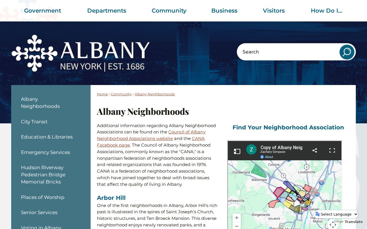
Use the city list to find a meeting or association contact pathway for an Albany neighborhood. It supports civic connection and local history, not a name search for nearby households.
Several associations named by the city and CANA have their own websites or social contact routes, including Center Square, Buckingham Lake, Helderberg, and Manning Boulevard. Their availability and records differ. The City of Albany and CANA sources should be treated as current civic contacts, while the parcel record remains the source for a legal lot and the Hall or library remains the source for historical occupants.
Albany Neighbors Civic Contacts
CANA is a nonpartisan city-wide federation founded in 1976. Its current association table, dated June 25, 2026, records president or contact, email, website or Facebook route, and 2026 dues-paid status where reported. That makes it useful for reaching a civic organization or checking whether an association has a public contact channel. It does not publish a list of member households, and no association contact should be treated as a list of Albany neighbors.
| Association group | Documented contact use |
|---|---|
| Arbor Hill, Beverwyck, and Delaware Area | CANA table lists a group-contact or social route; it does not supply a member roll. |
| Buckingham Lake and Center Square | Association or conservancy website routes are documented; use them for civic contact, not household identity. |
| Downtown, Eagle Hill, Helderberg, and Melrose | Contact, website, or social fields vary in the CANA update. |
| Crestwood and Whitehall | Included in the June 25, 2026 contact/status table; availability is association-specific. |
The CANA neighborhood association contacts table is the source for the current contact and status layer.
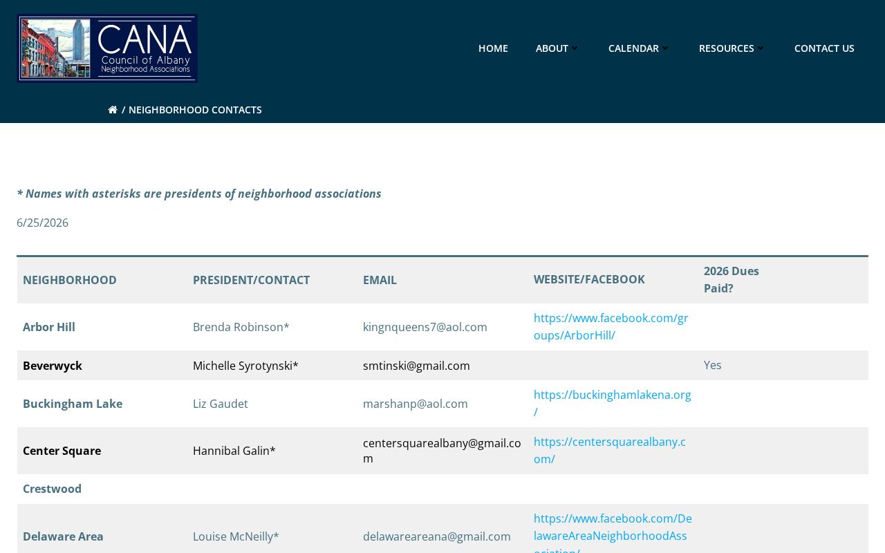
The visible fields are association contacts and civic links. They are useful when someone wants to connect with a neighborhood organization, but they are not proof that an individual lives on a particular block.
Albany Neighbors in Historical Records
Historical block research can begin at the Hall of Records or Albany Public Library after the modern parcel is identified. The Hall combines city and county archives that include assessment rolls, voters, maps, deeds, permits, and census material. Albany Public Library holds local directories, newspapers, obituaries, yearbooks, maps, and pamphlets. A Street Guide can connect a historical street number to a listed occupant; an alphabetical directory can add an occupation or business address. Both must be read with their edition year.
Street names, wards, and boundaries may have changed. The Hall guide documents former names such as Central Avenue as Bowery and Madison Avenue as Wolf or Wolfe, along with numerous ward changes. A missing name can reflect a former street name or ward arrangement rather than an empty lot. Preserve the original spelling, number, ward, and page reference. That small paper trail prevents a later record from being attached to the wrong Albany parcel.
Albany Neighbors: Official and Commercial Tools
Official sources and commercial neighbor tools serve different purposes. The official records identify their custodian and usually show the field, date, and access limit. Commercial compilation tools can combine property, marketing, court, and other sources, but their coverage can be uneven, old, or vulnerable to same-name matches. A category result should never replace the tax roll, map, clerk, or historical volume when a fact needs verification.
| Source category | Best use | Limit |
|---|---|---|
| Official parcel and deed records | Parcel identity, recorded owner, legal description, and document history | Does not identify every occupant or prove current presence |
| Official voter and historical volumes | Individual current registration or dated street and ward evidence | Current lookup is not block browsing; protected files remain unavailable |
| Commercial compilation category | Possible leads for facts requiring independent checking | May be stale, incomplete, or mix same-name people |
The local record most often dispels a common assumption: an owner field and mailing address do not list everyone who lives at the situs. Other household members, visitors, utility customers, and delivery records are not supplied by a parcel lookup. That boundary protects both accuracy and privacy.
Albany Neighbors Privacy Boundaries
Public parcel geometry does not erase privacy protections. New York's Address Confidentiality Program can provide an eligible participant with a substitute Albany mailing address while safeguarding the actual location. Confidential voter registration is maintained apart from public inspection for four years under Election Law §5-508. Voter records also exclude sensitive identification data. A search that returns no matching address may therefore be working as the law intends.
DMV address information is protected by federal law. Courts may redact or restrict personal information, and sealed material remains closed. Do not use a tax mailing address as a statement that the recorded owner is a neighbor. If a parcel trail stops, retain the documented result and use an official civic contact channel rather than trying to defeat a safety protection. The NYS Address Confidentiality Program provides the official explanation of its protections.
Lawful use. Use Albany neighbor records for civic connection, family history, property curiosity, or personal safety awareness. Do not use them to stalk, harass, intimidate, or harm anyone.